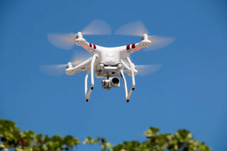


LiDAR on drones is changing the way we look at mapping and surveying. By combining laser technology with the mobility of drones, this approach allows for capturing highly detailed 3D data in record time, even in tricky areas. Whether it's dense forests or construction sites, LiDAR-equipped drones are proving to be a reliable tool for industries that need accurate and efficient mapping solutions.
Key Takeaways
- LiDAR on drones provides unmatched precision for creating 3D maps, even in hard-to-reach areas.
- This technology is being widely adopted across industries like agriculture, mining, and urban planning.
- Compared to older methods, LiDAR drones save both time and money while delivering better results.
- LiDAR works effectively in low-light conditions and can penetrate vegetation for ground-level details.
- Future developments, like AI and better drone hardware, will make LiDAR on drones even more powerful.
The Evolution of LiDAR on Drones
How LiDAR Technology Has Advanced Over the Years
LiDAR, short for Light Detection and Ranging, has come a long way since its early days. Initially, it was a bulky, expensive technology reserved for large-scale projects. Over time, advancements in miniaturization and cost reduction have made it accessible to a wider range of industries. Today, LiDAR sensors are compact enough to fit on drones, making them a game-changer for aerial mapping and surveying.
- 1970s: Early LiDAR systems used in atmospheric research.
- 1990s: Introduction of airborne LiDAR for mapping large terrains.
- 2010s: Miniaturized sensors enable integration with drones.
- 2020s: Affordable LiDAR drones become mainstream for industries like agriculture, construction, and forestry.
The Role of Drones in Modern Mapping
Drones equipped with LiDAR sensors have transformed modern mapping. These agile flying machines can navigate challenging terrains, offering a level of detail and accessibility that traditional methods simply can't match. Unlike ground-based or manned aircraft systems, drones can:
- Access remote or hazardous areas safely.
- Collect data faster, reducing time and labor costs.
- Generate high-resolution 3D maps in real-time.
For example, a Dual 4K Camera Foldable Drone not only provides stunning visuals but also complements LiDAR's precision, creating a versatile tool for mapping professionals.
Key Milestones in LiDAR Drone Integration
The journey of integrating LiDAR with drones has been marked by several milestones:
- First LiDAR-Equipped Drones: Early prototypes emerged in the late 2000s, combining basic drones with lightweight LiDAR sensors.
- Cost Reduction: By the 2020s, LiDAR sensors became more affordable, breaking barriers for smaller businesses.
- Software Advancements: Modern software now processes LiDAR data in real-time, making it easier to analyze complex terrains.
The evolution of LiDAR on drones isn't just about better technology—it's about making advanced mapping tools accessible to everyone, from big corporations to small startups.
Applications of LiDAR on Drones Across Industries

Transforming Agriculture with Precision Mapping
LiDAR-equipped drones are reshaping agriculture by delivering accurate, high-resolution data that aids in optimizing farm operations. Farmers can now monitor crop health, analyze soil composition, and map field elevations with unparalleled precision.
- Field Elevation Mapping: Helps identify water drainage issues and plan irrigation systems effectively.
- Crop Health Analysis: Detects stress in plants early, allowing for timely interventions.
- Yield Optimization: Provides data-driven insights to maximize productivity.
Farmers using LiDAR drones are finding it easier to tackle challenges like uneven terrain and water distribution, leading to healthier crops and better harvests.
Enhancing Safety in Mining and Construction
In mining and construction, safety and efficiency are paramount. LiDAR drones excel at providing detailed 3D models and real-time data that improve decision-making.
- 3D Modeling: Creates accurate representations of mines and construction sites for better planning.
- Hazard Detection: Identifies unstable structures or areas prone to collapse.
- Progress Monitoring: Tracks the development of projects, ensuring timelines are met.
For instance, the 6-Channel 6-Axis Pocket Drone could be a compact yet effective tool for quick assessments in tight or hazardous spaces.
Revolutionizing Urban Planning and Infrastructure
Urban planners are leveraging LiDAR drones to design smarter, more sustainable cities. These drones collect data that aids in infrastructure development and maintenance.
- Topographic Surveys: Offers detailed maps for planning roads, bridges, and buildings.
- Utility Inspections: Assesses the condition of power lines, pipelines, and other critical infrastructure.
- Disaster Preparedness: Maps floodplains and other risk-prone areas to improve emergency response.
With LiDAR drones, urban development is becoming more data-driven, reducing costs and improving the quality of life for city residents.
Technical Advantages of LiDAR on Drones
High-Resolution 3D Mapping Capabilities
LiDAR-equipped drones are game-changers when it comes to creating detailed 3D models. Unlike traditional methods, which can struggle with lighting or obstructions, LiDAR uses laser pulses to map terrain with incredible precision. This technology captures even the smallest details, making it ideal for complex projects like urban planning or forestry management.
- Generates highly accurate topographical maps
- Penetrates dense vegetation to reveal ground-level details
- Produces data that’s ready for analysis with minimal processing
Overcoming Terrain Challenges with Laser Precision
One of LiDAR’s standout features is its ability to handle tough terrains. Whether it’s steep mountains, dense forests, or hard-to-reach areas, drones equipped with LiDAR sensors can navigate and collect data efficiently. This versatility makes them invaluable for industries like mining, construction, and environmental monitoring.
By eliminating the need for on-ground surveys, LiDAR drones reduce risks and improve safety in hazardous environments.
Cost and Time Efficiency Compared to Traditional Methods
Traditional surveying methods often require a lot of manpower, time, and equipment. LiDAR drones, on the other hand, are faster and more economical. They can cover large areas in a fraction of the time, cutting down costs significantly.
Advantages of LiDAR Drones Over Traditional Methods:
| Feature | LiDAR Drones | Traditional Methods |
|---|---|---|
| Speed | High | Moderate to Low |
| Cost | Lower operational costs | Higher due to labor and equipment |
| Accessibility | Handles rough terrains | Limited in challenging areas |
For those looking to streamline their processes and save resources, LiDAR drones are a no-brainer.
LiDAR on Drones vs. Photogrammetry

Key Differences Between LiDAR and Photogrammetry
LiDAR and photogrammetry are both powerful tools for creating 3D maps, but they achieve this in very different ways. LiDAR uses laser pulses to measure distances and create high-resolution 3D models, while photogrammetry relies on overlapping photographs to calculate distances and generate maps. Here's a quick comparison:
| Feature | LiDAR | Photogrammetry |
|---|---|---|
| Data Collection | Laser pulses | High-resolution images |
| Performance in Dense Vegetation | Strong (can penetrate foliage) | Weak (blocked by obstructions) |
| Light Requirements | Works in low light or darkness | Requires sufficient natural light |
| Cost | Generally higher | More cost-effective for small projects |
Advantages of LiDAR in Dense Vegetation and Low Light
One of LiDAR's standout benefits is its ability to capture data in environments where photogrammetry struggles. For example:
- Dense Forests: LiDAR can penetrate tree canopies to map the ground below.
- Low Light Conditions: Since LiDAR doesn't rely on natural light, it works just as effectively at night or in shaded areas.
- Complex Structures: Narrow objects like power lines or roof edges are captured more accurately with LiDAR.
In contrast, photogrammetry excels in open, unobstructed areas where light is abundant, such as open fields or urban landscapes.
When to Choose LiDAR Over Photogrammetry
Deciding between LiDAR and photogrammetry often depends on the project requirements. Here’s when LiDAR is the better choice:
- Mapping areas with dense vegetation, like forests or jungles.
- Surveying narrow or intricate structures, such as power lines or pipelines.
- Conducting nighttime or low-light surveys.
Photogrammetry, on the other hand, is ideal for:
- Projects with large, open landscapes and minimal obstructions.
- Small-scale mapping tasks where budget is a concern.
- Situations where visual textures and colors are needed for analysis.
In the end, the choice between LiDAR and photogrammetry isn't about which is better—it's about picking the right tool for the job.
Future Trends in LiDAR Drone Technology

AI Integration for Smarter Data Analysis
Artificial intelligence is changing the game for LiDAR drone operations. AI tools can process massive datasets faster and with greater accuracy than ever before. Tasks like identifying terrain patterns, classifying objects, and generating 3D models are becoming more automated. This means less time spent on manual analysis and more actionable insights for industries like agriculture, construction, and disaster response.
Advancements in Drone Hardware and Autonomy
The hardware in drones is getting a serious upgrade. Expect to see longer battery life, increased payload capacity, and sensors that capture even more precise data. Autonomous flying capabilities are also improving. This means drones can handle complex flight paths without constant human control, saving time and reducing human error. For beginners, drones like the Adventure Ready Dual Camera Folding Drone are making it easier to start exploring aerial mapping.
The Role of Real-Time Connectivity in Mapping
With 5G and IoT technologies, real-time data sharing is becoming a reality. Drones equipped with LiDAR sensors will be able to transmit high-resolution data instantly. This is huge for industries like emergency response, where immediate access to mapping data can make all the difference. It’s not just about speed—it’s about making better decisions, faster.
The future of LiDAR drones isn’t just about better tech. It’s about making mapping faster, safer, and more accessible for everyone.
Best Practices for Using LiDAR on Drones

Choosing the Right Drone and Sensor
Selecting the right equipment is the foundation of any successful LiDAR operation. Here’s what to consider:
- Drone Type: Fixed-wing drones are ideal for covering large areas, while multi-rotor drones excel in precision mapping of smaller or more complex terrains.
- Sensor Compatibility: Make sure the LiDAR sensor is compatible with your drone model, both in terms of weight capacity and power needs.
- Project Needs: Identify whether your project requires high-resolution data or broader coverage, then choose a sensor with the appropriate range and accuracy.
Operational Guidelines for Accurate Data Collection
To get the best results, follow these steps:
- Flight Planning: Outline the flight path to ensure full coverage of the area. Consider terrain, obstacles, and weather conditions.
- Altitude and Overlap: Maintain a consistent altitude and overlap between flight paths for seamless data stitching. For example, a 100-foot altitude with 25-foot overlap often works well.
- Pre-Flight Calibration: Always calibrate the LiDAR sensor before takeoff to adjust for environmental factors and ensure accurate readings.
Post-Processing Techniques for Optimal Results
Once the data is collected, the real work begins:
- Data Cleaning: Remove noise and irrelevant points to focus on meaningful data.
- Software Tools: Use specialized LiDAR software for processing and analyzing the data. Many tools offer features like automated classification and 3D modeling.
- Validation: Cross-check the processed data with ground control points or other reference points to verify accuracy.
Pro Tip: A well-planned workflow, from equipment selection to post-processing, can save you hours of rework and improve the quality of your results.
For those just starting out, consider experimenting with a Fixed Wing Airplane RC Toy to practice flight dynamics and gain a better understanding of aerial operations.
When using LiDAR with drones, it's important to follow some key tips to get the best results. First, make sure your drone is stable and flying at the right height. This helps capture clear images. Also, check the weather before flying; clear skies are best for good data. Lastly, always review your data after the flight to ensure everything looks right. For more helpful tips and resources, visit our website!
Conclusion
LiDAR-equipped drones have truly changed the game when it comes to mapping and surveying. They’ve made it faster, safer, and way more efficient to gather detailed data, even in places that are tough to reach. Whether it’s creating 3D models for construction projects, helping farmers monitor crops, or aiding in disaster response, these drones are proving their worth across all kinds of industries. As the technology keeps improving, with things like better sensors and AI-powered analysis, it’s clear that LiDAR drones are here to stay—and they’re only going to get better.
Frequently Asked Questions
What is LiDAR and how does it work on drones?
LiDAR, which stands for Light Detection and Ranging, uses laser beams to measure distances. On drones, it sends out laser pulses that bounce off objects and return to the sensor. This data is then used to create detailed 3D maps of the area.
How is LiDAR different from photogrammetry?
LiDAR uses laser light to measure distances, making it effective even in low light or dense vegetation. Photogrammetry, on the other hand, relies on photos to create maps, which can be limited by lighting and obstacles.
What industries benefit the most from LiDAR drones?
LiDAR drones are widely used in industries like agriculture, construction, forestry, mining, and urban planning. They help with tasks such as mapping, monitoring, and analyzing data efficiently.
Are LiDAR drones expensive to use?
While LiDAR drones used to be costly, advancements in technology have made them more affordable. They also save money in the long run by reducing labor and time needed for traditional surveying methods.
Can LiDAR drones work in bad weather or at night?
Yes, LiDAR drones can operate in low-light conditions and even at night because they don’t rely on sunlight. However, heavy rain or fog might affect the accuracy of the readings.
What should I consider when choosing a LiDAR drone?
You should look at factors like the drone’s flight time, the range and resolution of the LiDAR sensor, and the specific needs of your project. Compatibility with software for data analysis is also important.